


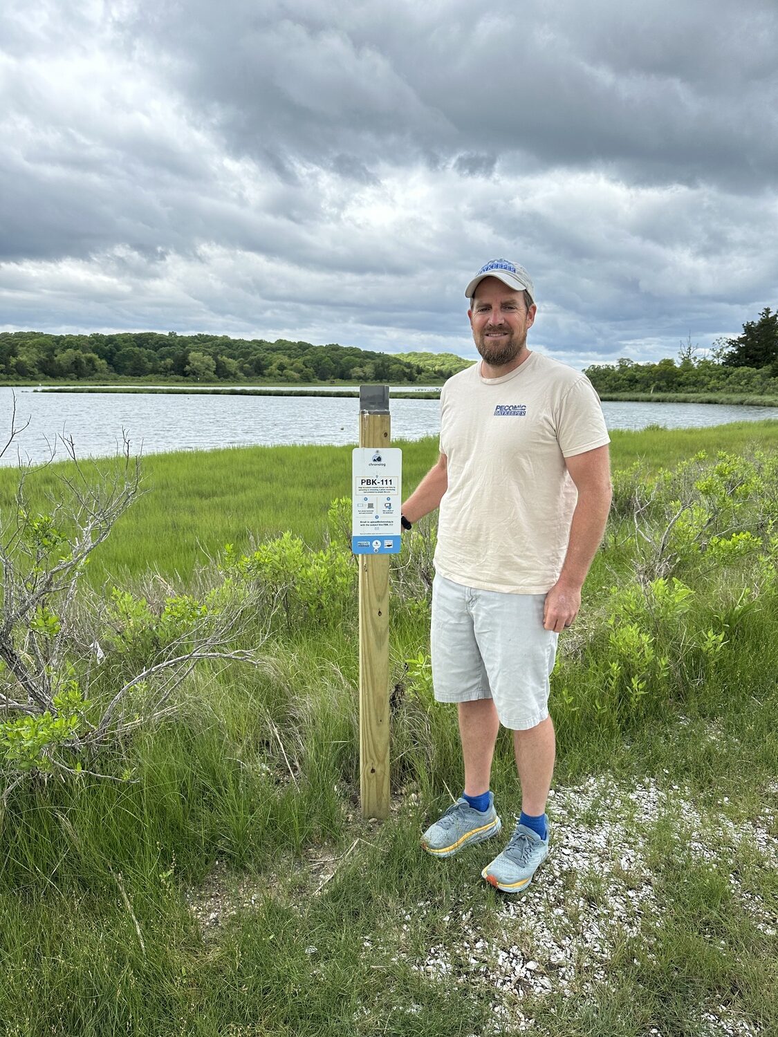
Pete Topping, Executive Director of Peconic Baykeeper. DAN STARK
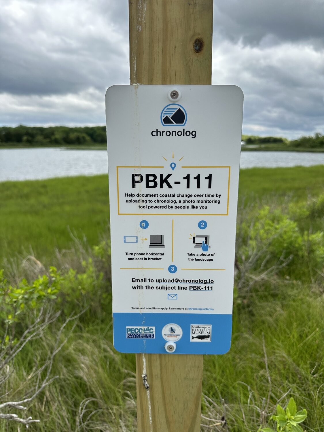
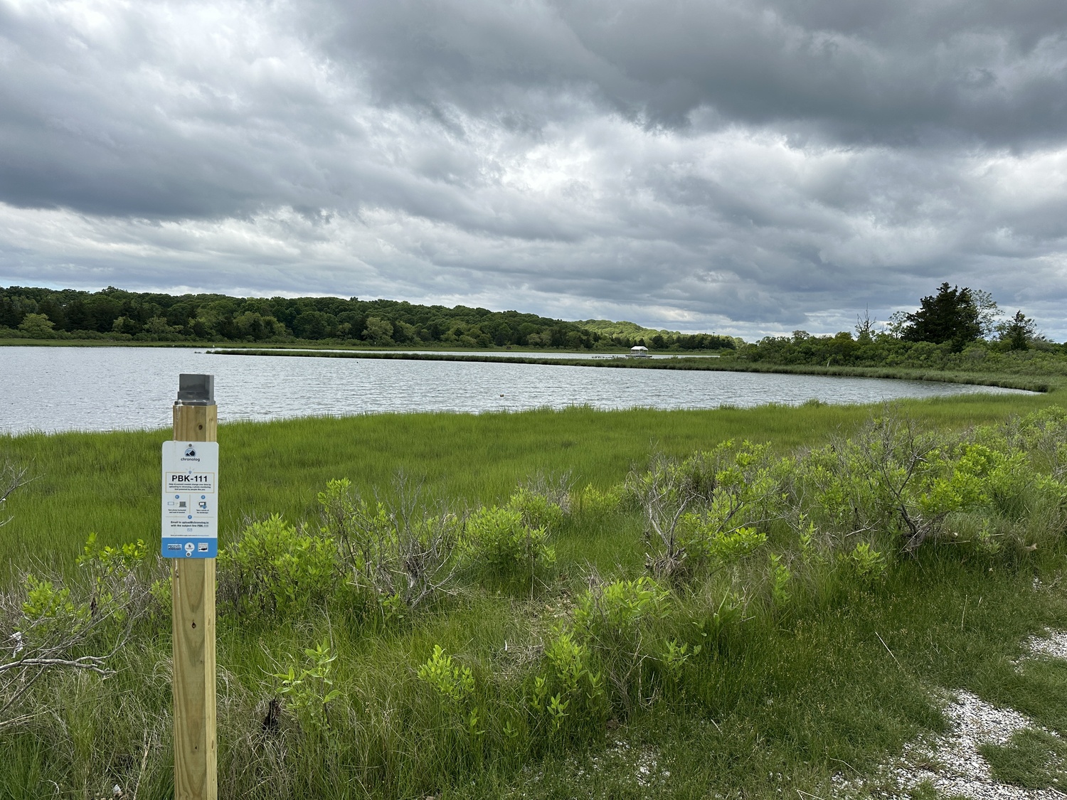
Chronolog station at Conscience Point. DAN STARK
Chronolog Station at Conscience Point. DAN STARK
Peconic Baykeeper has launched Project R.I.S.E. (Recording Inundation Surrounding the Estuary), a new environmental initiative centered around documenting changes in the Peconic Estuary.
The project is focused on increasing public awareness of how the coastal landscapes of the estuary are changing by encouraging the public to take pictures of local landscapes and uploading them to an app. This is the first time that Peconic Baykeeper, a local nonprofit organization focused on protecting local watersheds, has taken on a project that focuses on an overall look at the estuary and requires community participation.
“The project is the first initiative that we’ve undertaken to help document the changes that the Peconic Estuary is undergoing in a more holistic sense rather than looking at individual sites or how individual projects and actions impact the ecosystem,” said Peter Topping, the executive director of Peconic Baykeeper. “We are also relying on direct engagement from the community to assist in these efforts.”
There are 15 locations throughout the Peconic Estuary, which spans from Riverhead to Montauk and includes bodies of water like Peconic Bay, Noyack Bay and Gardiners Bay, where the public can find photo stations planted by the group detailing how they can participate. Current locations include Conscience Point in Southampton, Indian Island County Park in Riverhead and Montauk Point State Park.
The project utilizes Chronolog, an environmental monitoring app used to collect photos to track changes. The app is also used by the New York State Department of Environmental Conservation at four locations on Long Island, two of which are located along the Peconic River.
The top of the photo stations feature a bracket where users are instructed to place their phone horizontally and take a picture of the landscape. The angles were chosen specifically to capture “open vistas and fairly compelling scenes” to document, according to Topping.
Once the picture is taken, users then email the picture to upload@chronolog.io with a subject line unique to each location. Upon sending, the person will get a confirmation email and a link to a timelapse that includes all of the photos taken at that location as well as a short summary of the location and its history.
The goal of the project is to visually show the changes in the landscape of the Peconic Estuary and its effects, which includes increases in algae blooms, brown tides and coastal flooding, changes that Topping said he has observed in his lifetime as someone who grew up in Southampton.
“Changes that I have observed in my lifetime include the prevalence of harmful algal blooms beginning in the mid-’80s with brown tides followed by the emergence of rust tides in more recent years,” said Topping. “I have also observed increased coastal flooding events throughout the Peconic, which was the main impetus for the project.”
Topping said that having a timeline of photos showing coastal environmental changes draws the public and local officials to take notice of the issue more and start a dialogue about these changes.
“Photos documenting changes over time present a compelling story that we hope can be used to foster both the dialogue and policy needed to address the very real threat of sea level rise along our vulnerable shoreline,” said Topping.
Another aspect of having the visual timeline is that it changes the public’s baseline of what they view to be normal environmental changes. Topping talked about the concept of “shifting baselines” and how those who are new to the area have a different perception of these changes compared to those who have lived near the estuary longer and have seen more dramatic changes occur.
“Those new to the area start their baseline from the time of arrival, so they lack the historical perspective of what this ecosystem looked like in a healthier state,” said Topping. “This also includes what is considered ‘normal’ as far as coastal flooding, harmful algal blooms and the frequency and intensity of extreme weather events.”
Peconic Baykeeper has also partnered with nonprofit groups including the Peconic Land Trust and the Southampton History Museum and public landholders like Riverhead Parks and Recreation and Suffolk County Parks in order to secure locations and support for the project.
Currently, there is no time frame that the project is operating under, nor is there a quota of photos that needs to be collected. The main focus is to spread awareness of coastal changes and start a conversation among the public.
“We don’t want a photo per hour or a photo per day,” said Topping. “But we want people to start the story and see what happens and see how certain areas change more than others.”
To commemorate the launch of the project, the group is offering tours of three different sites where photo stations are involved on Thursday, June 20. Tours will be offered at the New Suffolk Waterfront at 10 a.m., Peconic Riverfront Park at noon and at Conscience Point at 2 p.m.
For more information about Project R.I.S.E. and Peconic Baykeeper, visit peconicbaykeeper.org/programs/project-r-i-s-e.


